AeroMegh
Drone Data Analytics
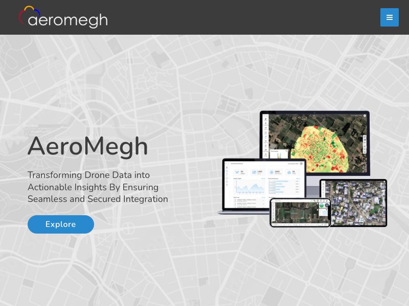
AeroMegh is a SaaS platform designed to Transform Drone Data into Actionable Insights. AeroMegh Product offers services from Flying and Capturing Drone Data to Processing and Visualizing Drone Data to further analysing to obtain desired outputs in real-time.
1. AeroGCS KEA Enterprise : https://aeromegh.com/aerogcs-kea
AeroGCS KEA is one of its kind, smart and empowering mission planner. It is technically strong with unparallel features. AeroGCS KEA has comparable characteristics of the bird “KEA”. AeroGCS KEA has proven its benchmarking performance, globally.
2. DroneNaksha : https://aeromegh.com/dronenaksha
DroneNaksha is designed with a thought of delivering one of its kind, drone survey and mapping experience.
DroneNaksha is a SaaS (Software as Service) from AeroMegh platform for various photogrammetry solutions. Along with orthomosaic, DroneNaksha also generates other data types like Digital Surface Model, Digital Elevation Model, Vegetation using various photogrammetry algorithms.
3. PicStork : https://aeromegh.com/picstork
PicStork helps automate end-to-end aerial image analytics right from capturing images to processing the data.
Users of PicStork can bring their data, train detectors and analyse data, everything on their own.

More products
Find products similar to AeroMegh
 71
71DigiParser
Extract data from documents and emails
 138
138Shortpen
A powerful link management platform to shorten URLs
 100
100SaaSCurate
Community platform for SaaS founders.
 95
95Best DNS for gaming
Find the best DNS option for you
 87
87Job Locator
Find Software Engineer jobs posted within 24hours
 214
214Themisforcrypto
Unleash the Power of Cryptocurrency AI Trading